While eastern Quebec and the Maritimes are still recovering from the devastating effects of Fiona Passage, another tropical system has formed far away in the Caribbean.
What do we know?
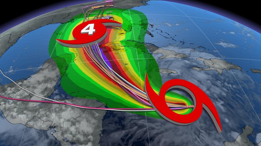
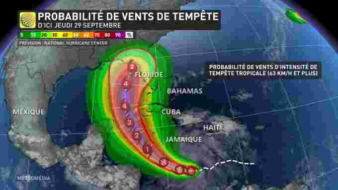
Ion, the ninth system in the Atlantic basin, is currently a tropical cyclone with a minimum central pressure of 1003 Mb. At the moment, it is following a northeasterly trajectory, which will allow it to gain intensity thanks to the warm waters of the Gulf of Mexico.
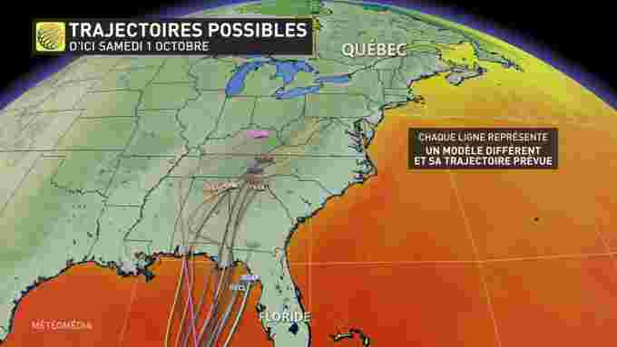
The island of Cuba was the first to suffer the consequences. A significant amount of rain and strong winds are expected in some of its sectors at the beginning of the week. After that, Ian is expected to reach the Florida Keys around mid-week.
It is moving towards becoming a big storm
However, by the time it leaves Cuba and reaches the North American continent, the system should have intensified enough to be considered a major hurricane.
Whether it will maintain the same strength as it hits Florida remains uncertain. But the National Hurricane Center still issued a warning about its arrival and urged residents of the Sunshine State to prepare.
arriving late
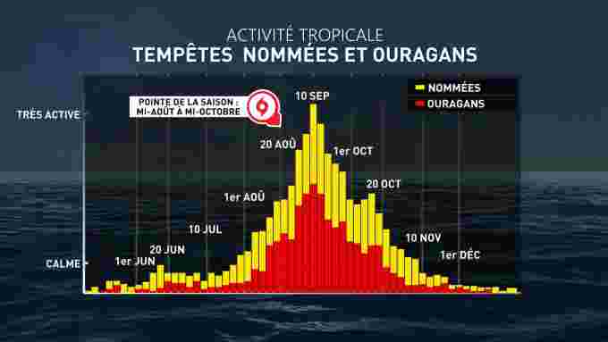
According to statistics, the tropical season reaches its peak in the Atlantic basin by September 10. Moreover, on average, the first major hurricane appears on September 1.
But right now, there are three developing storms, Gaston, Hermine and Ian – which will become the second major hurricane – as well as the remnants of Fiona. What’s more, the depression is visible on the radars as well. If it gains strength, it could be the tenth named system: Julia. Autumn therefore does not occur under the sign of calm for the Atlantic basin…
In collaboration with Kevin Cloutier, meteorologist





More Stories
Allegations of corruption Qatar warns of ‘negative impact’ of European measures
USA: Famous “Hollywood cat” euthanized in Los Angeles
The campaigner who called for the shooting of Ukrainian children has not been charged