In collaboration with meteorologist Kevin Cloutier
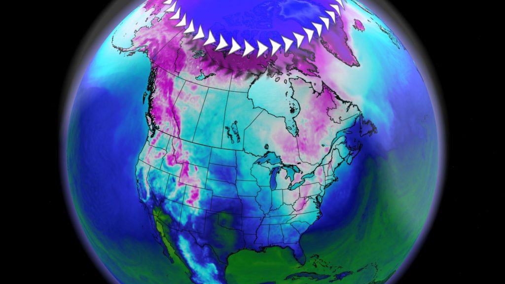
The polar vortex plays an important role in the cold season in the Northern Hemisphere. Although it is present throughout the year, it weakens in summer. However, here he is setting the table for winter.
Good to know – The polar vortex is an area of low pressure in the Northern Hemisphere that extends from the surface to the stratosphere. It acts like a giant storm that covers the entire North Pole of the globe and is a result of the large difference in solar radiation between the equator and the North Pole. It generally has the coldest air in the hemisphere.
Taking power now
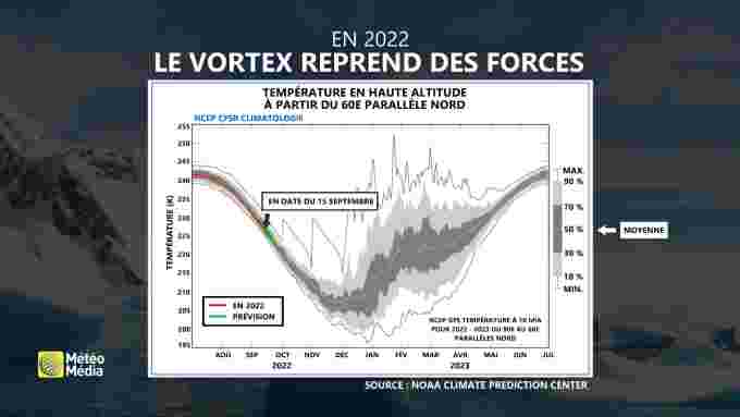
A reduction in the sun’s influence in northern regions, unique to autumn, effectively allows it to regain its lead. In September and October, the polar vortex gains strength – and quickly.
Two factors must be considered: its temperature and its pressure. Its cooling accelerates, losing heat to the solar star. Moreover, as pressure drops at the heart of the polar vortex, its size and influence increases, preparing for the return of the cold season.
It usually reaches its peak in November, when it is at its strongest. This takeover is happening right now, many kilometers above our heads.
However, the exact behavior of the vortex still holds many mysteries. Its evolution over the next few months is difficult to predict with certainty.
Remember that La Niña has been stable in the Pacific Ocean for the third winter in a row. This affects the behavior of the polar vortex. However, the winter season will be shaped by these two important players.
Some possibilities
One thing is certain: the polar vortex has a direct effect on regions in the Northern Hemisphere – of which Quebec is clearly a part. While its influence can be felt during the fall, the polar vortex really puts all its cards on the table in the winter.
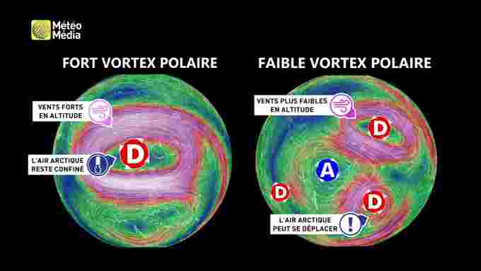
In summary, two main curves are possible: strong vortex or weak vortex.
A stronger vortex Generally the coldest air is confined to arctic regions. Therefore it is less likely to dive deep into North America and Europe, limiting colder escapes. It can be seen as a shield against cold wind. In this case, winters tend to be less towards our latitudes.
However, the reverse is also possible. Sudden stratospheric warming may still occur along the way. If this happens, the polar vortex loses its feathers. A weak vortex Arctic mass is difficult to contain. Cold descents are more frequent and more significant in North America and Europe. Worse yet: Such a scenario would favor climate stagnation above Greenland, promoting long glacial periods in Quebec.


More Stories
Allegations of corruption Qatar warns of ‘negative impact’ of European measures
USA: Famous “Hollywood cat” euthanized in Los Angeles
The campaigner who called for the shooting of Ukrainian children has not been charged