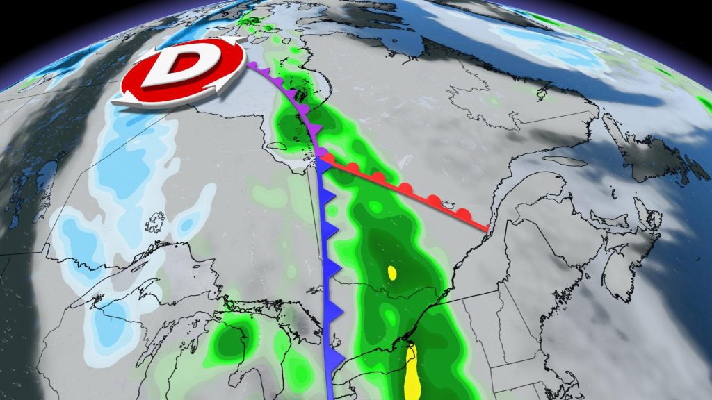
A low pressure system moves in on Thursday and threatens to extend its visit through Saturday. The western and southern Quebec sectors are first on the list and may be affected during the day on Thursday. It will turn the center of the province on Friday, before reaching the tip of Gaspé and the North Shore on Saturday.
This low pressure is likely to send moisture from the southern United States. Result: The amount of water available in clouds is significant. Everything points to precipitation being very abundant and some areas could receive 50mm of water – or more.

The exact path of the system is still uncertain and the most affected areas may change over the next few days depending on the behavior of the depression.
Good winds are also possible: maximum 70 km/h. As usual, eastern Quebec is likely to experience strong winds and gusts of up to 80 km/h.
The first autumn storm
With the onset of cold weather that comes with the onset of fall, the stage is set for the birth of beefy systems: fall storms. The latter are often synonymous with violent winds and heavy rains, and damage can be substantial.
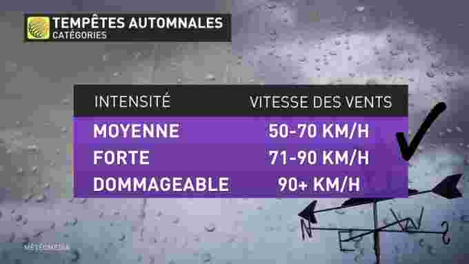
The current disturbance looks like an autumn storm. However, its intensity should oscillate between medium and strong depending on the sector. There is a possibility of property damage due to floods. A power outage cannot also be ruled out.
On average, this type of depression enters the equation in mid-September.


More Stories
Winter Storm Watches Issued Across Newfoundland
Trump Orders U.S. Government to Cut Ties With Anthropic Amid AI Dispute
Allegations of corruption Qatar warns of ‘negative impact’ of European measures