In short:
- Early October is unusually dry;
- The trend has reversed;
- The table is set for strong fall systems.
For the past 10 days, there has been a peaceful atmosphere across the country. Much of Canada has seen below-average rainfall since early October.

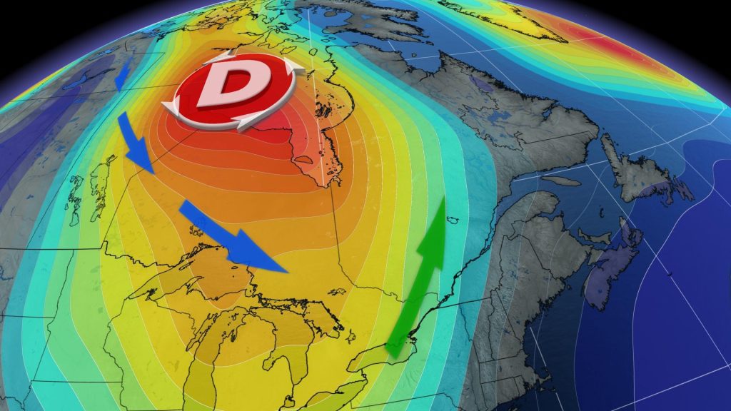
Two factors explain this trend, depending on where you are in the landscape. The climate peak brought unusual heat and persistent drought to Western Canada. Several heat records — some dating back to 1891 — were shattered in British Columbia over the past 10 days.
Meanwhile, the reverse happened in the eastern part of the country. Quebec is in the grip of a marked atmospheric trough, which promotes the descent of arctic air from the north of the continent. Result: The situation is not favorable for the passage of low pressure systems.
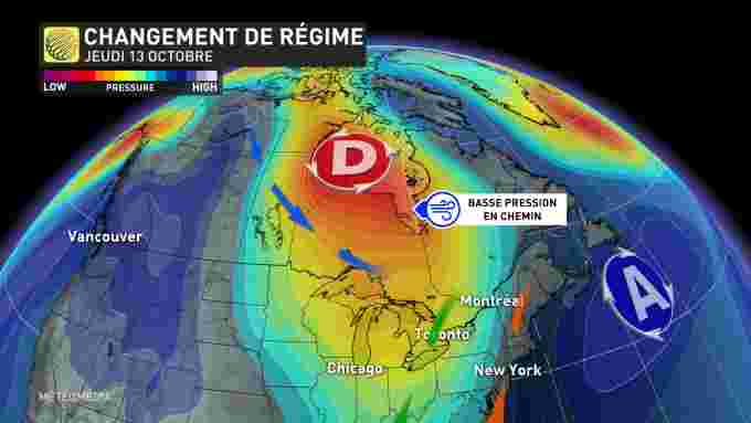
paradigm shift
However, this trend is coming to an end. A strong disturbance crossing Canada from west to east over the next few days will bring an end to this dry spell. This is the first in the list (it could be very long). Indeed, the jet stream is likely to settle in the Belle Province and wreak havoc in the coming weeks with several disturbances. Quebec can be particularly spoiled.
Snow is likely to be worth its two cents everywhere in Quebec: Colder temperatures forecast for the next fourteen days could set the table for snowflakes.
The door is open to fall systems
A significant temperature difference between air masses, the jet stream is well established in Quebec: all the ingredients for fall storms. Remember that these depressions, typical of the current season, often bring abundant precipitation and, above all, strong winds.


More Stories
How List Acquisition Helps Your Political Campaign Become Successful
Four escaped cows were caught
A simple administrative decision? | Press